

Kas is THE most beautiful place we visited on Turkey’s Turquoise Coast (although Fethiye was quite impressive as well). With beautiful hidden beaches and shiny blue seas, there is tons to do in and around Kas. When we came to Kas we found ourselves looking up at the mountains behind the town and wondering … “Can we hike up there?“.
After doing a quick Google search we found that indeed we could hike up to the top of the mountain behind Kas, and in fact this hike has a name … the ‘Sleeping Giant Trail’.
The Sleeping Giant Trail is how those who are hiking The Lycian Way descend into the town of Kas for a few nights, before continuing on their month long hike. Allow for us to share with you our experience hiking The Sleeping Giant Trail.
🇹🇷 Things to Book NOW for Kas 👇
- Kekova Sunken City & Simena Castle Tour 🛶 (must do)
- Rental Car 🚙 (definitely want a car for kas)
- Neva Kas Hotel 🏨 (amazing value for the price)
- Ferry to Kastellorizo, Greece 🇬🇷 (day trip)

Hiking the Sleeping Giant Trail
Quick Facts
Length: 1.2 miles to the top from start of trailhead, 2.4 miles round-trip
Time: About 1 hour up, 45 minutes back
Difficulty: Easy to Moderate – Switchbacks up the whole way
Terrain: Dirt and rocks – Easy – Not Very Slippery or Challenging
Footwear: Sneakers or Hiking Shoes – Don’t need hiking shoes – I did it in my barefoot shoes
Views: Beautiful – Sometimes shaded, sometimes sunny
What is the ‘Sleeping Giant Trail’?
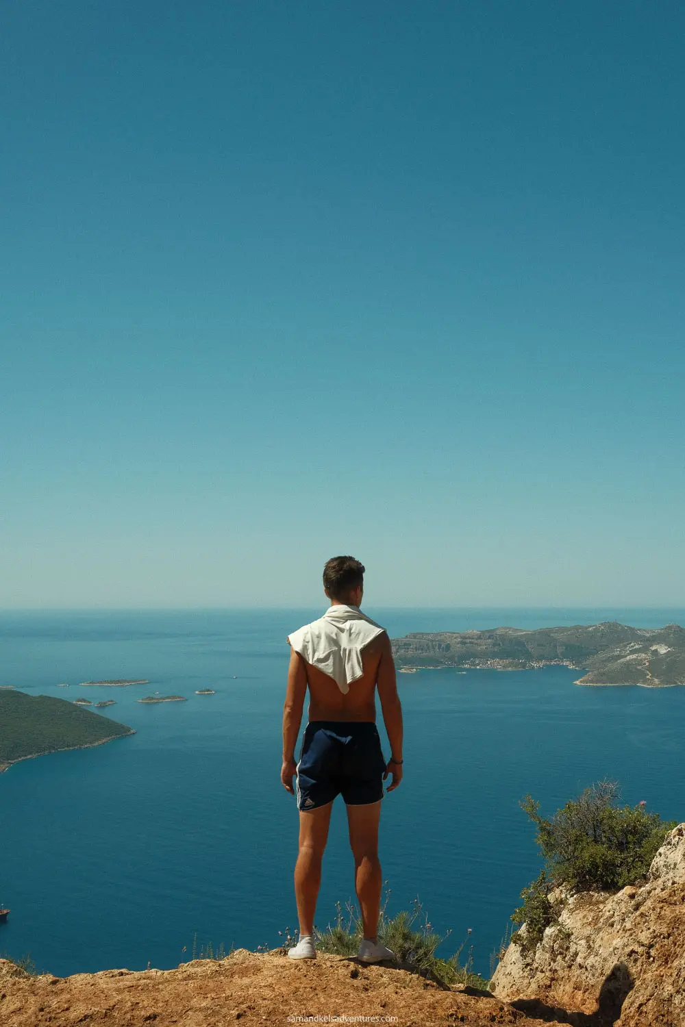
The Sleeping Giant Trail is a hike that takes you up to the peak of the mountains behind Kas. The trail starts at the edge of Kas and continues 1.2 miles up into the mountains. The trail consists mainly of switchbacks going back and forth, until you reach the top of the mountain. As you ascend up the trail, you get a beautiful panoramic view of the Kas Peninsula, as well as the Greek island of Kastellorizo – which you can easily visit as a day trip from Kas. You can easily see the small Greek town on the edge of the island, as most of the island is filled with mountains and is uninhabited.


Climbing the Sleeping Giant took us about 1 hour to get to the top, and 45 minutes to get back down to the trailhead. Heading up the mountain is decently steep but it’s not too long of a hike which makes it doable for pretty much anyone. You do not need special shoes for this as the trail is pretty well defined and packed with dirt and rocks.
➡️ Read: The 8 Best Things to Do in Antalya 🌊 ✨

Where is the Trailhead?
The trail begins at the red pin below. You can find the exact coordinates here. The photo below is the route from our hotel in Kas to the trailhead (walking). Depending on where you are staying in Kas, it should take you about 20 minutes to walk here. If you have a car or a motorbike, you could also drive here easily, as there is tons of parking in the area.

On Google Maps you cannot specifically see the trail’s twists and turns, but you can on Strava. So if you like to see specifically where you need to go, we recommend you download Strava. I posted a screenshot here of what I am looking at on Strava. I do not have Strava premium, but I can clearly see the trail that zig-zags back and forth through the mountains. If you use Strava to orient yourself to get to this hike, you will be fine.

If you aren’t one to use maps, that will be perfectly fine for this hike as well, as the trailhead is quite easy to find, and once you’re on it, the trail is very defined all the way up. There is no need to use your phone to follow the trail for this hike.
The entrance to the hike starts to the right of the main road, on a brown rock path that is covered by a lot of brush. It almost looks wrong, but if it looks like you are following the right location based on your maps location, then you are going in the right direction.
➡️ Read: 10 Day Turkey Itinerary 🇹🇷
How Hard is the Hike?
The trail is decently steep and goes upwards the whole time for about an hour. It’s a good trail so you won’t have to worry to much about slippage or tough climbs. We would say this is between Easy and Moderate. Anyone coming to Kas can do this hike, with the exception maybe of a 75 year old grandma.
You will be walking through some shaded tree areas, some bigger rocks, and through a lot of bushes! Looking back, Kelsey says she might have worn pants, but it was still pretty hot out so maybe not. The choice is yours.
You will also pass by a cave on your way up, that is when you know you are going in the right direction and almost to the top. Once you get to the summit, you will need to turn left and make your way to the edge of the hill to get the views. There are many different trails around the top of the hike, so make sure you just orient yourself to where the ocean is and remember which trail you came up on and you will be just fine 🙂
➡️ Read: Complete Guide to Visiting Pamukkale ✨


Is Hiking the Sleeping Giant Trail Worth It?
We would say definitely yes for three reasons. ⬇️ ⬇️
1 Unbelievable views from the top, as well as during the hike. 🌁 🗻
2 A great way to start the day. ☀️ Switch things up from laying on the beach all day.🥾
3 It’s not that hard. An hour up and 45 minutes back isn’t too bad. Pretty much anyone could do this hike. 😌 ✨

Summary – Sleeping Giant Hike Kas
With all this being said, we hope you enjoy your hike up the Sleeping Giant Trail near Kas. We were very glad we did this hike. The views from the top are unforgettable. The hike also helps you understand where everything is in the area, as the views from the top make it very clear where Greece is, where the Kas Peninsula is, etc.
Enjoy the hike!


thanks for the great article, keep up the good work